GeoSightOps
Advanced incident management solution for public safety agencies, providing real-time geospatial insights, AI-powered analytics, and seamless interoperability with modern data ecosystems.
Real-Time Alerts
Create custom alerts based on thresholds, geofences, and business logic
AI-Powered Analytics
Leverage machine learning for predictive insights and automated responses
Seamless Interoperability
Connect any data source with 50+ protocols and streaming platforms
Everything You Need for Situational Awareness
Build business logic and alerts without being overwhelmed by data. Our platform organizes information into logical categories so you can focus on what matters.
Smart Alerts System
Create and monitor alerts based on data thresholds, geofences, and custom conditions. Get notified when it matters most.
Geospatial Intelligence
Visualize sensor data and events on interactive maps. Track movement, monitor zones, and analyze spatial patterns.
Custom Dashboards
Build personalized dashboards with maps, charts, cameras, and real-time widgets tailored to your operations.
Task Management
Create location-based tasks with AI assistance. Use board view, assign to team members, and track progress on the map.
Team Communication
Direct messaging and group chat capabilities integrated with the map. Share files, notes, and coordinate in real-time.
Role-Based Access
Define organizational roles like incident commander, security operations, or liaison officer with appropriate permissions.
Forms & Reports
Generate ICS forms with AI assistance. Request reports as tasks and maintain comprehensive documentation.
Camera Integration
Stream live camera feeds directly into your dashboard. Monitor multiple video sources alongside geospatial data.
Connect Any Data Source
Seamlessly integrate with modern data ecosystems. GeoSightOps supports 50+ protocols, message queues, and cloud platforms out of the box.
Eliminate the noise. We help you create and monitor alerts based on the data, thresholds, and values you set — including geofence triggers for intelligent notifications.
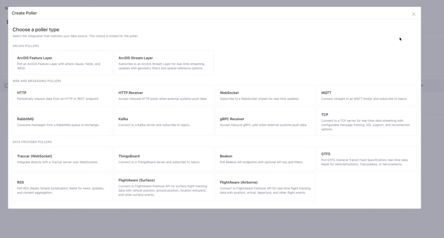
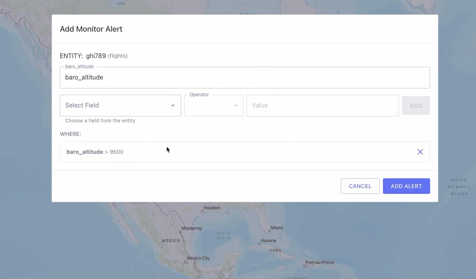
See GeoSightOps in Action
Real screenshots from the platform showing how easy it is to connect data sources and configure intelligent alerts.
Data Source Integration
Choose from 20+ poller types to connect your data sources
Monitor Alert Configuration
Set up custom alerts with flexible conditions and thresholds
50+
Integration Protocols
Real-Time
Data Processing
AI-Powered
Form Generation
Ready to Transform Your Operations?
Get started with GeoSightOps today and experience the power of real-time geospatial intelligence.