The Command Platform Built for Real Operations
GeoSightOps is not another dashboard. It’s a mission-tested geospatial command and control platform that gives your team shared situational awareness, smarter alerts, and faster response.

Affordable, Comprehensive,
Mission-Ready
Purpose-built for the agencies that protect communities, secure infrastructure, and respond to emergencies.
- NIMS ICS compliant with all standard FEMA forms built in
- Integrates with existing CAD, RMS, IoT, TAK, and video systems
- Self-hosted or cloud — full data control, no vendor lock-in
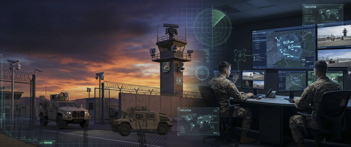
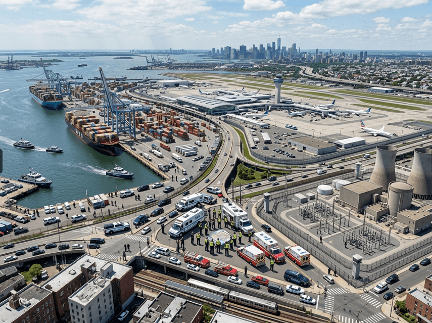
- Ports, airports, cities, critical infrastructure, public safety
- Affordable real-time C2 platform — enterprise power, accessible pricing
Why Organizations Choose GeoSightOps Over Everything Else
From small agencies to large multi-site operations — here is why GeoSightOps is the command platform of choice.
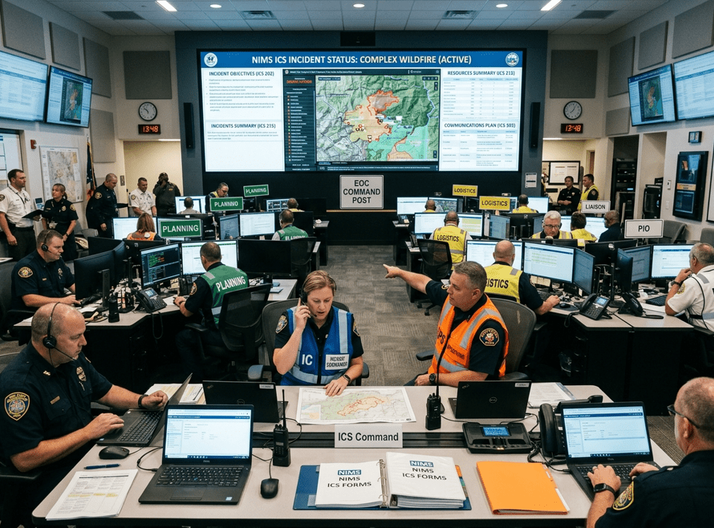
NIMS ICS Compliant — Out of the Box
Every FEMA Incident Command System form (ICS 201–221) is built directly into the platform. No third-party add-ons, no custom development.
Integrates with 650+ Systems
CAD, RMS, AIS, TAK, IoT sensors, video systems, and over 650 SaaS services. If your system has an API, GeoSightOps can connect to it.
True Multi-Platform — Web, iOS, Android, Windows
Runs natively on all four platforms. Commanders on web, field teams on mobile, control rooms on Windows — all synchronized in real time.
Self-Hosted or Cloud — Your Choice
Deploy on your own infrastructure for complete data sovereignty, or let us host it. Hybrid deployments are fully supported.
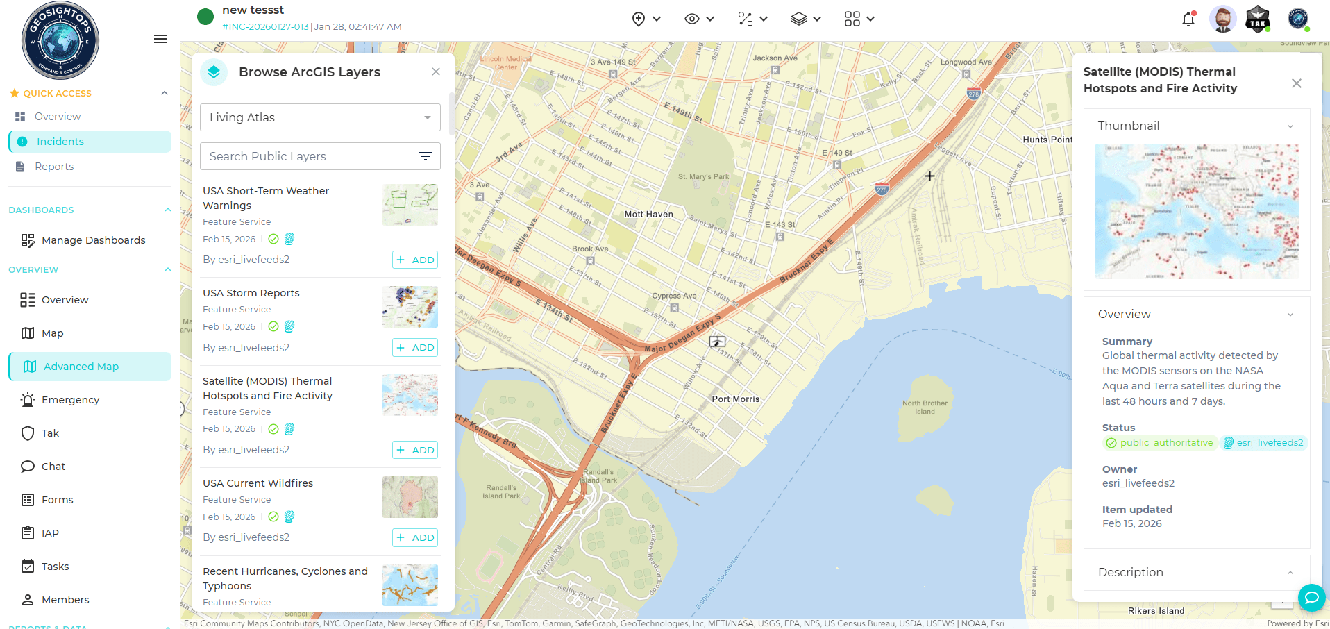
No GIS Vendor Lock-In
Works equally well with ESRI ArcGIS and open-source GIS like GeoServer, MapServer, and QGIS Server. Never forced into one ecosystem.
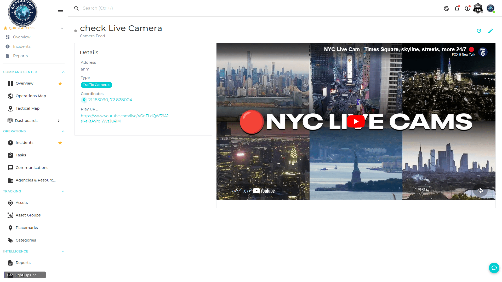
Live Video with AI Analytics
Connect any camera — RTSP, RTMP, WebRTC, HLS, YouTube — directly on the map. AI object detection runs automatically, no extra software.
Rules Engine — Act on Intelligence, Not Noise
Define your own business rules, geofences, and threshold alerts. Only the right person gets notified — via SMS, email, or push.
Full TAK & Satellite Integration
Bi-directional sync with ATAK, WinTAK, iTAK, and WebTAK. Garmin InReach, SPOT, ACR/Artex satellite devices fully supported.
IoT & Sensor Ready
Connect ThingsBoard, AWS IoT, Azure IoT via MQTT, WebSockets, LoRaWAN, OPC UA, and more — all visualized live on your map.
See What Makes the Platform Different
Real screenshots from GeoSightOps — showing exactly what your team will see on day one.
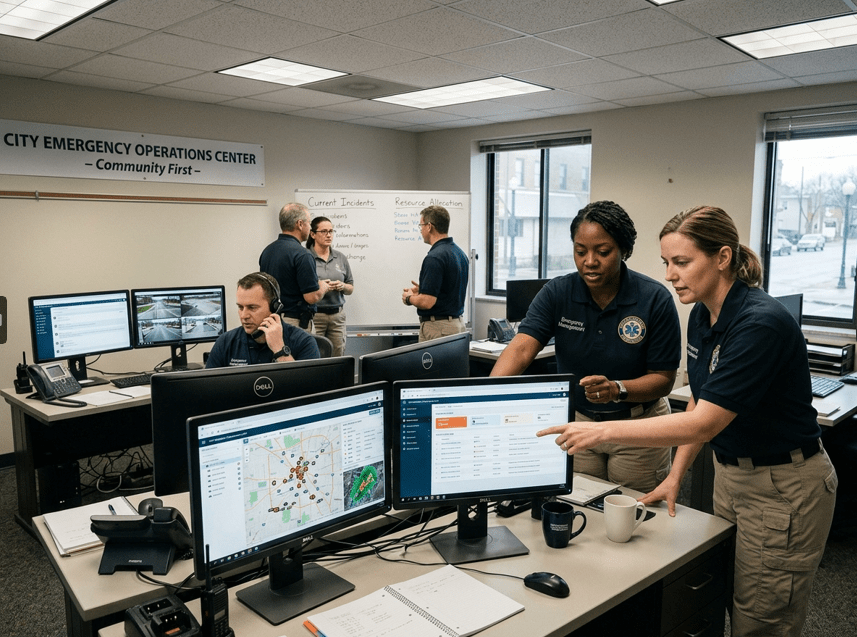
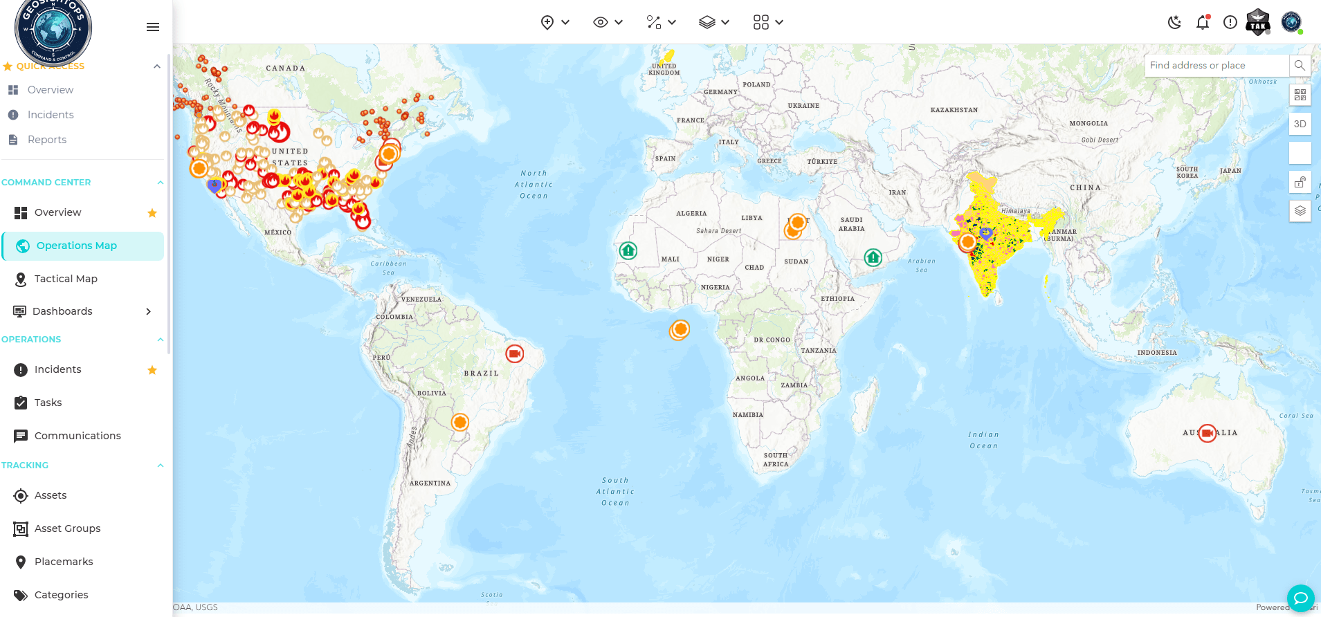
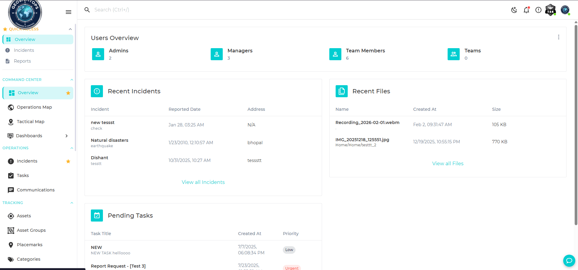
Everything on One Map — Assets, Incidents, Sensors, Video
All your data layers on a single live map. Role-based controls mean every operator sees exactly what they need.
- AIS vessel tracking, GPS assets, and IoT sensors in real time
- Live camera feeds placed directly on the map
- Shared situational awareness across agencies
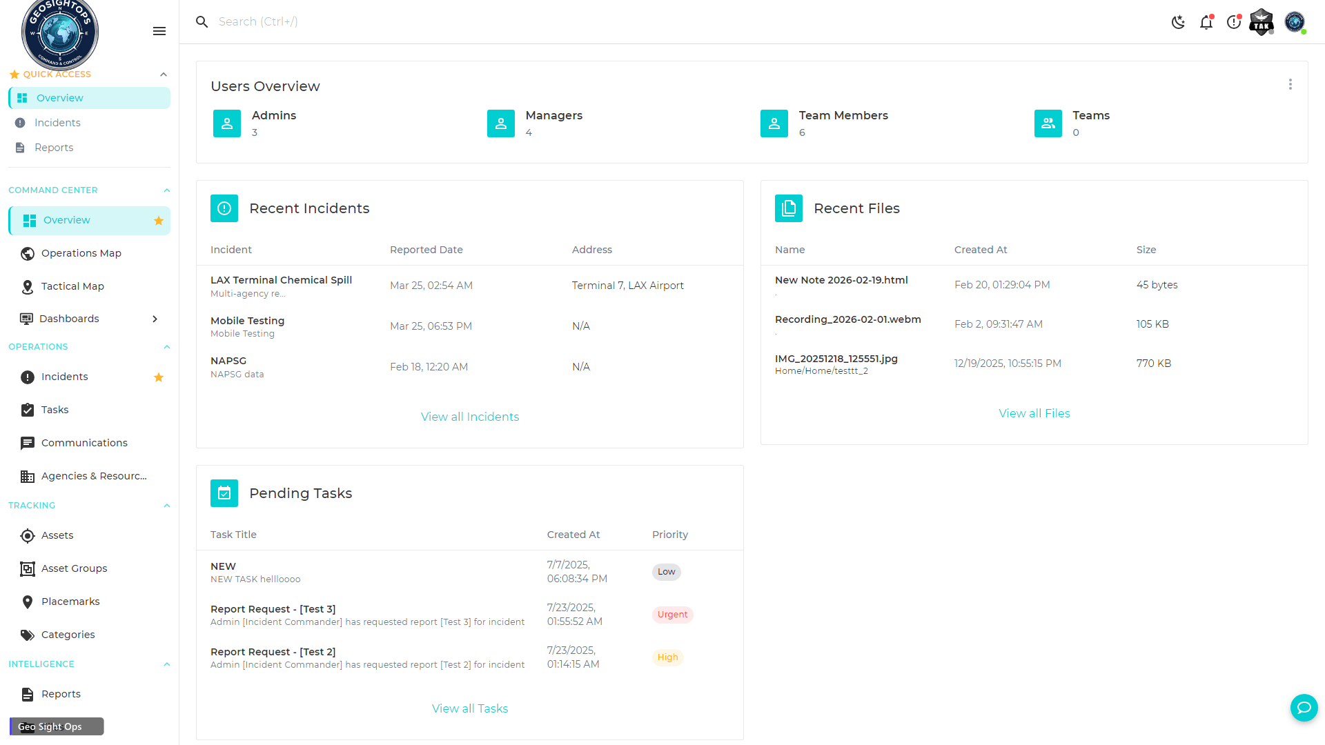
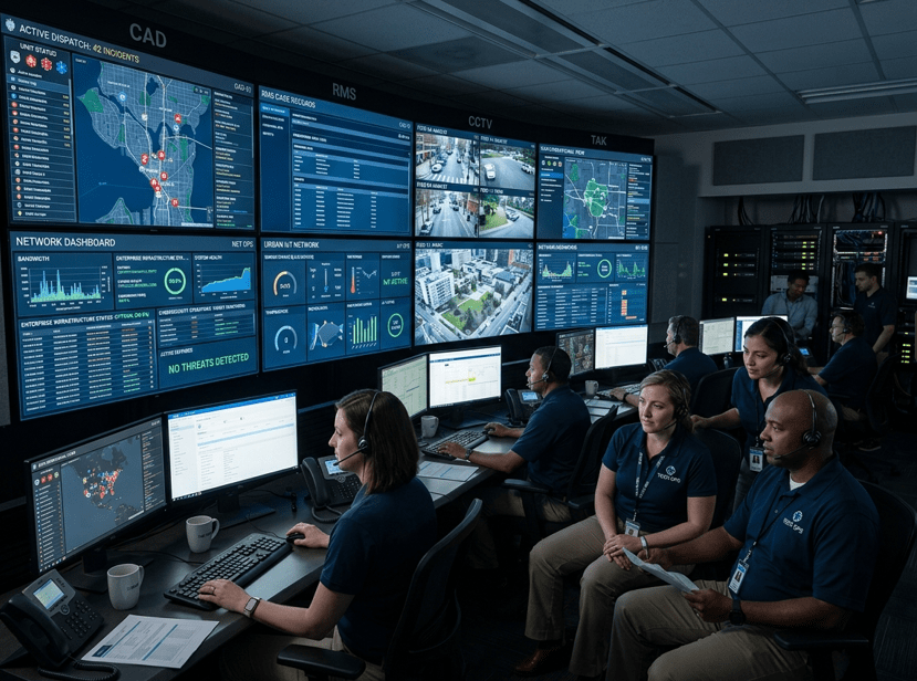
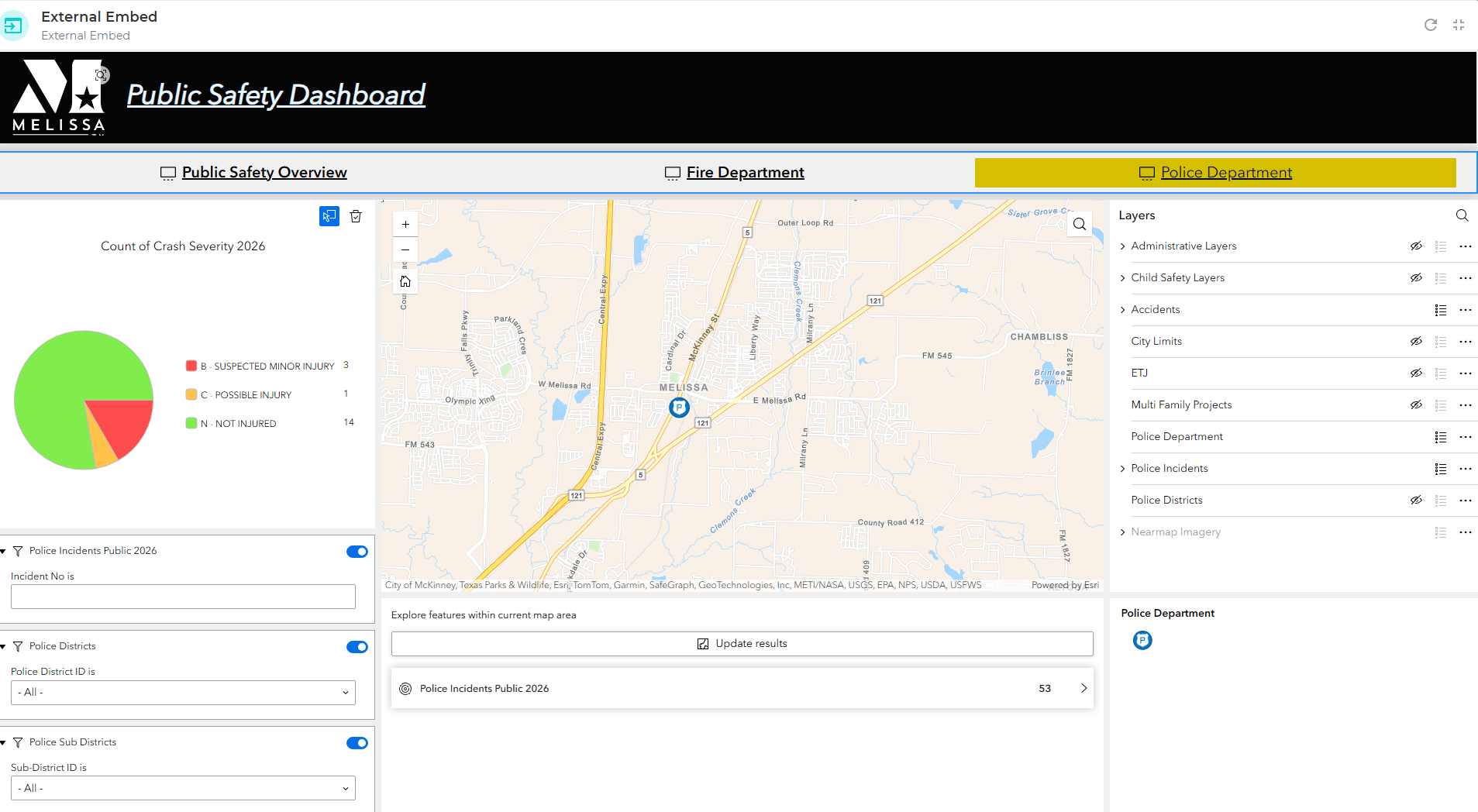
Unlimited Custom Dashboards — Drag, Drop, Deploy
Build dashboards for operations, command, security, and maintenance. Every widget is resizable and fully configurable.
- Role-based dashboard permissions for every user
- Real-time KPIs, incident boards, and alert panels
- External web page widgets for weather, fleet, and more
A Unified Platform — Not a Collection of Tools
Designed from the ground up as one integrated system. No stitching together of separate apps. One login, one data model.
- Single login for all platform capabilities
- Unified data model across maps, incidents, dashboards
- Consistent UX across Web, iOS, Android, Windows
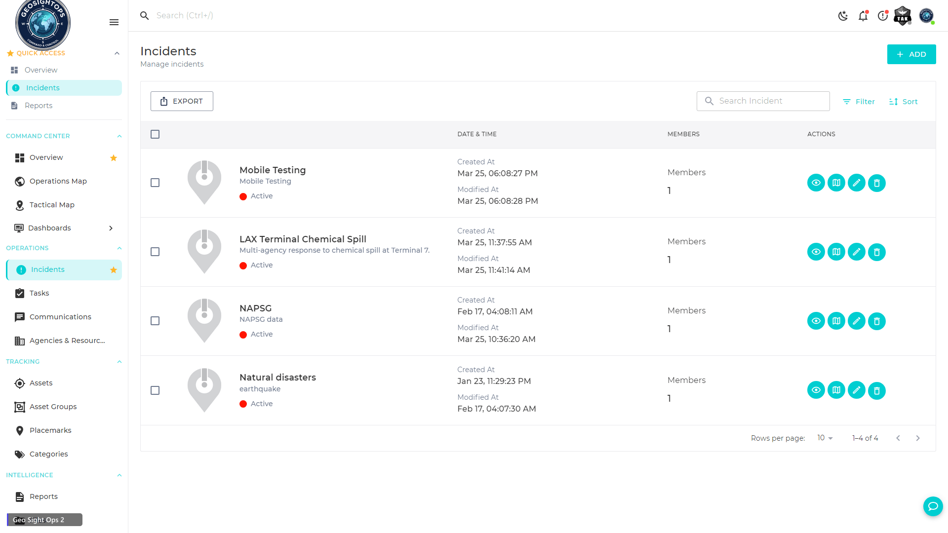
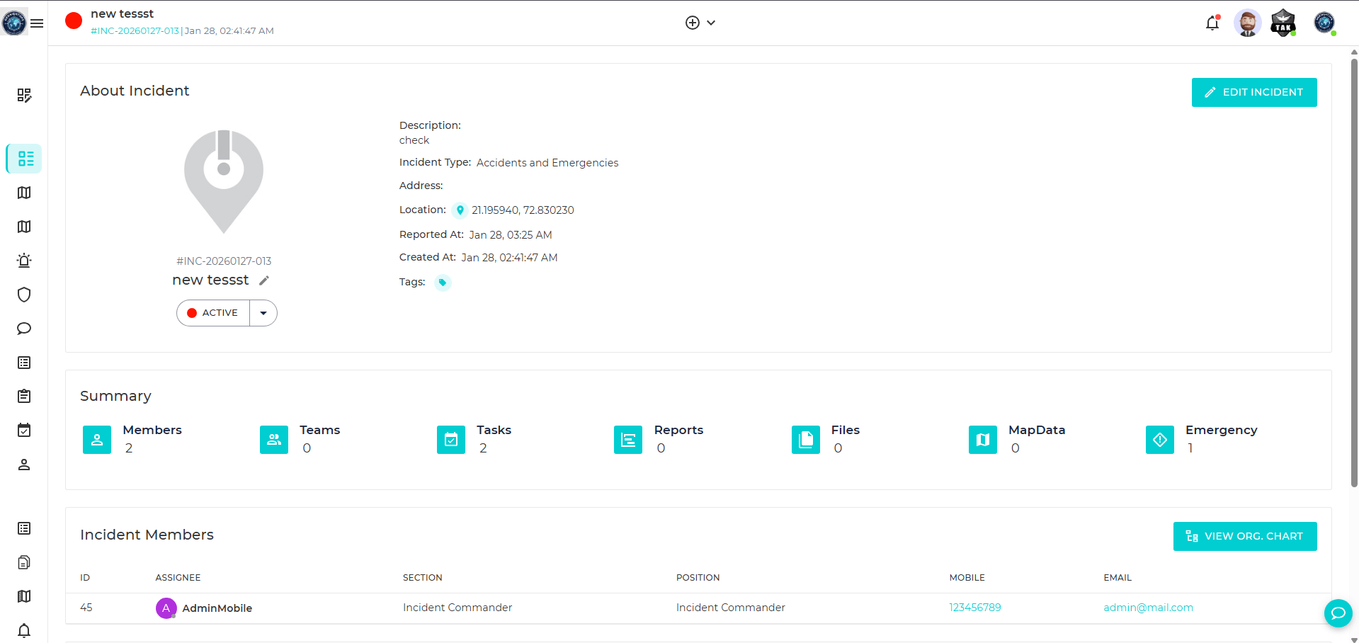
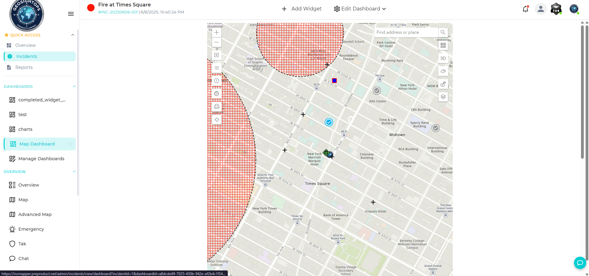
Map-Based Incident Command — Built for the Field
Create and manage incidents directly on the map. Assign resources, track response, and coordinate field teams in real time.
- Incident Command Post tools and resource tracking
- CAD and RMS integration for dispatch workflows
- All FEMA ICS 201–221 forms built in and PDF-exportable
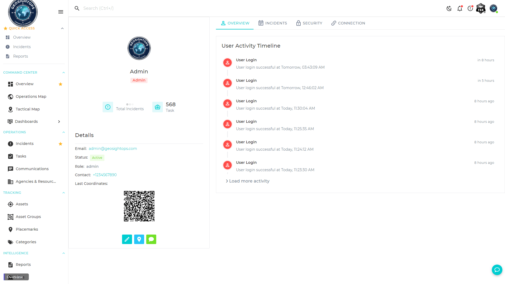
See It in Action
Real GeoSightOps platform screens — not mockups.
Who Uses GeoSightOps
From ports and airports to public safety agencies and campuses — GeoSightOps adapts to your operational environment.
GeoSightOps vs. Other Platforms
See how GeoSightOps stacks up against other solutions on the market.
| Capability | GeoSightOps | Legacy GIS Platforms | Generic Dashboards |
|---|---|---|---|
| NIMS ICS Forms Built-In | ✓ | — | — |
| Multi-Platform (Web, iOS, Android, Windows) | ✓ | — | — |
| Self-Hosted Deployment | ✓ | — | — |
| TAK & Satellite Integration | ✓ | — | — |
| AIS Vessel Tracking | ✓ | Add-on | — |
| AI Video Analytics | ✓ | — | — |
| 650+ Integrations | ✓ | — | Limited |
| Indoor Mapping (IMDF) | ✓ | Add-on | — |
| AI-Powered Form Builder | ✓ | — | — |
| Custom Rules Engine & Geofencing | ✓ | Limited | — |
| Affordable for Small Agencies | ✓ | — | Varies |
Ready to See It with Your Own Data?
Schedule a live demo and we will show you exactly how GeoSightOps integrates with your existing infrastructure.